Projects
Interactive maps, data visualizations, and geospatial tools I've designed and built.
Web Application
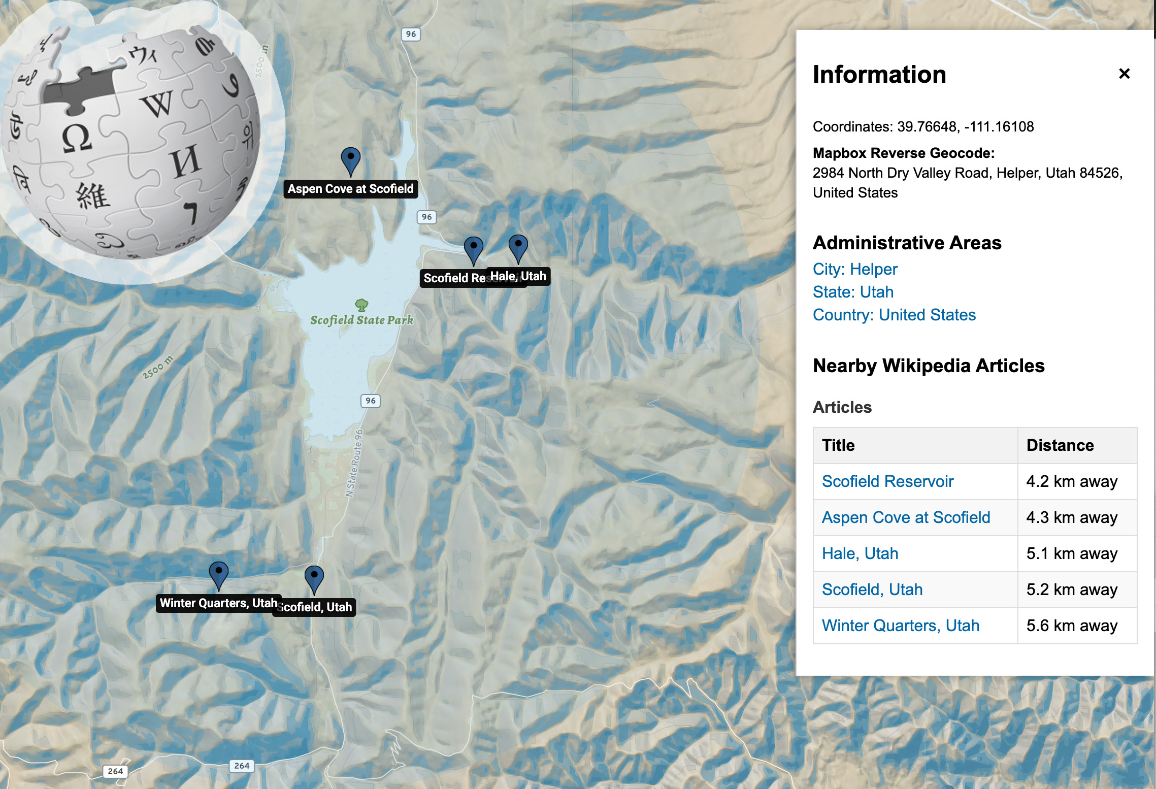
Wikipedia Mapper
Explore Wikipedia articles near any selected location on an interactive map.
Mapbox
Wikipedia API
JavaScript
Map Style
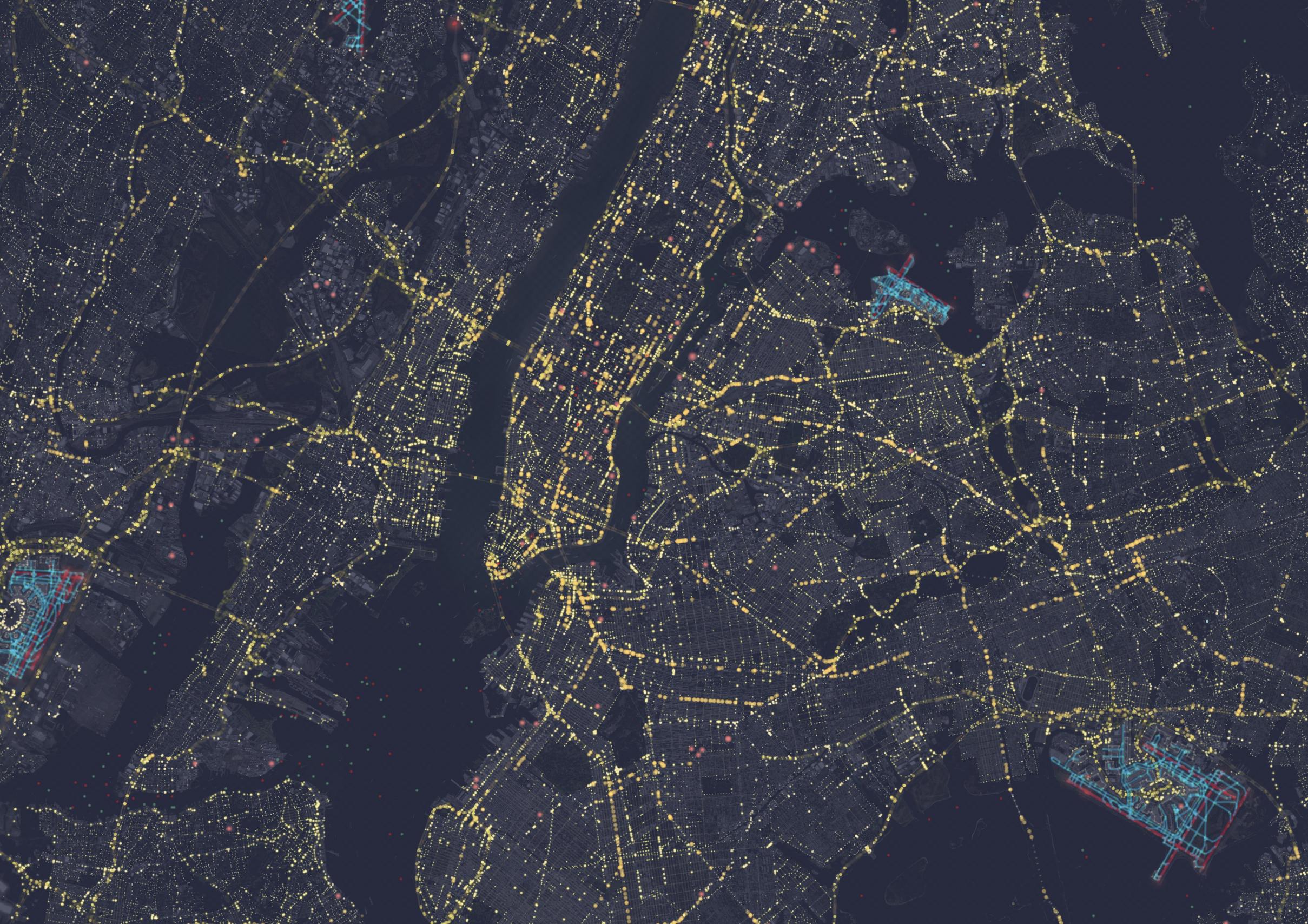
Night Flight
A custom Mapbox globe style that simulates the Earth at night with city lights.
Mapbox GL
Custom Style
Data Visualization
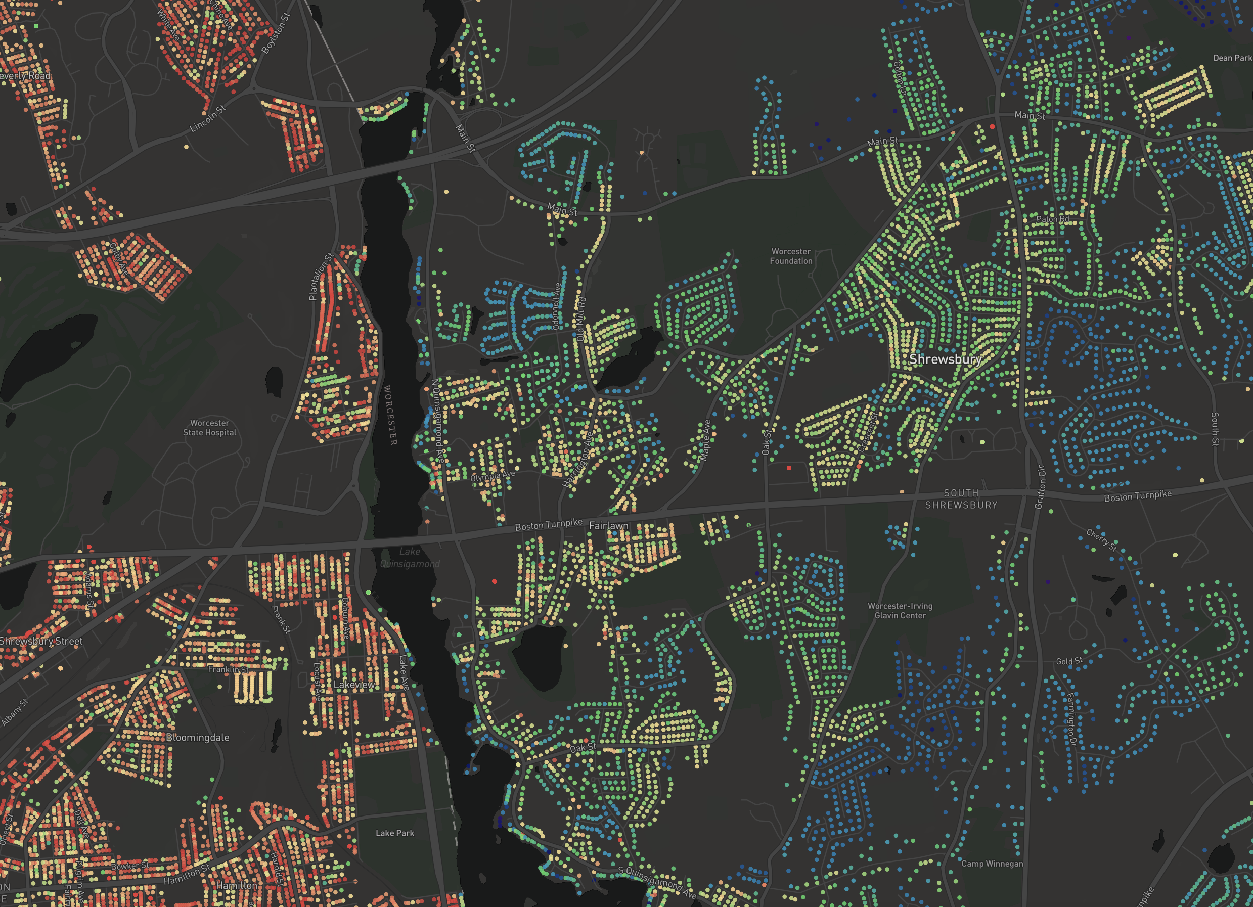
Property Values Map
Interactive choropleth of residential property values across Massachusetts.
Mapbox
Vector Tiles
Data Visualization
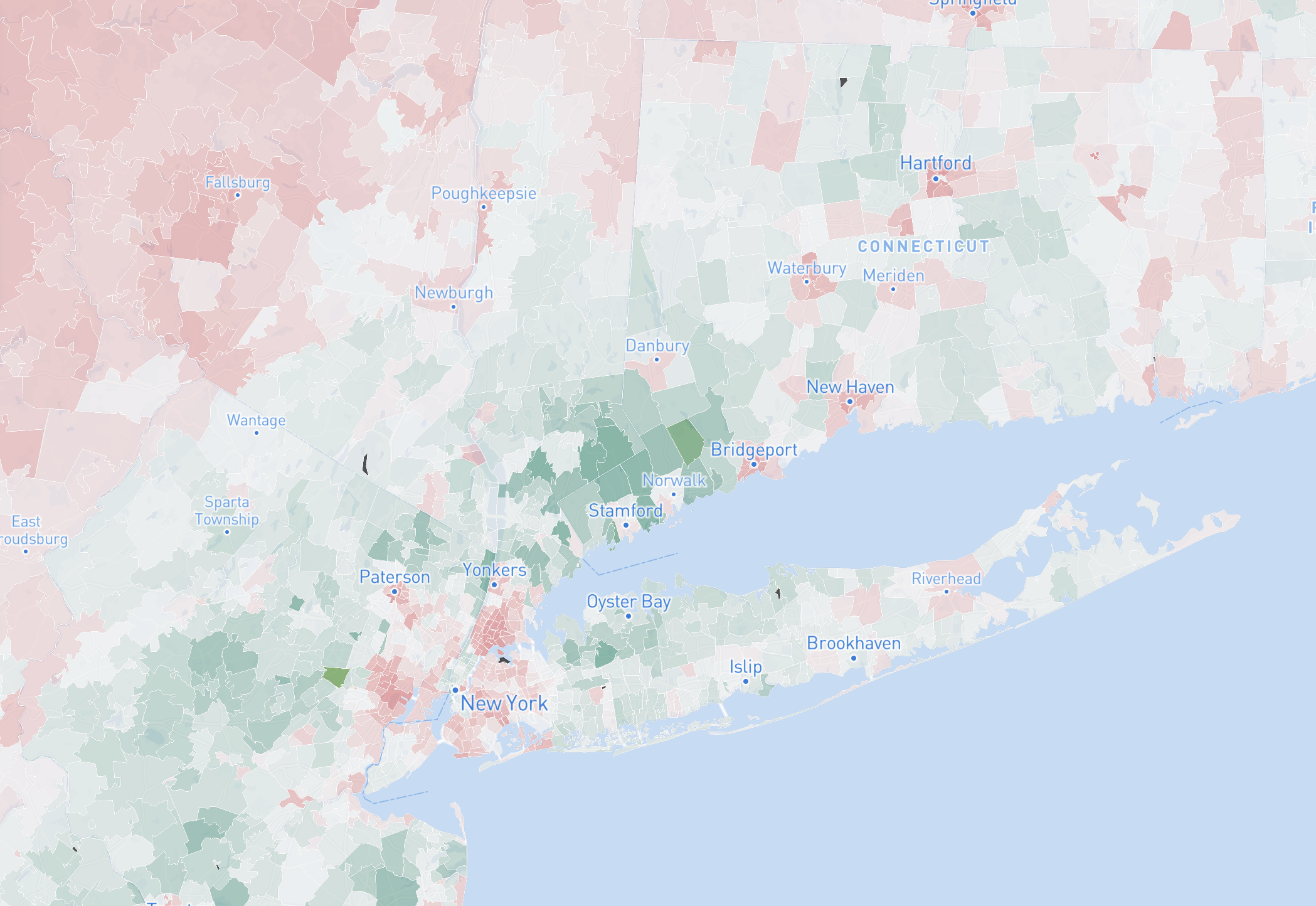
USA Zipcode Statistics
Interactive map of US ZIP codes by household income with Chart.js analytics.
Mapbox
Chart.js
Census ACS
Earth Observation
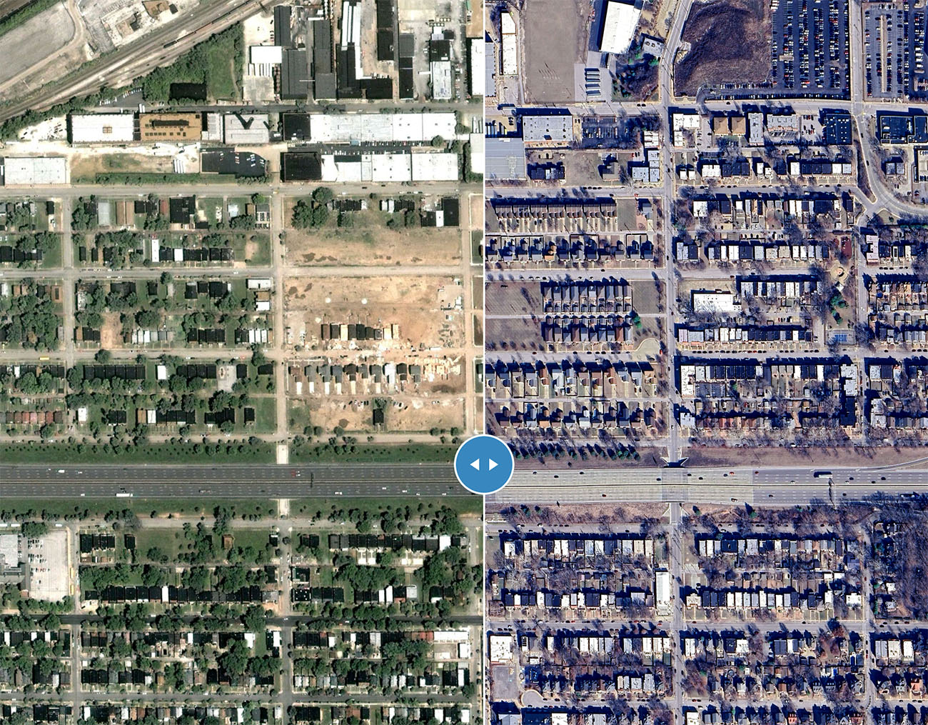
STL Historic Imagery
Swipe-compare tool for before/after aerial photography in St. Louis, MO.
Mapbox Compare
Aerial Imagery
Geospatial
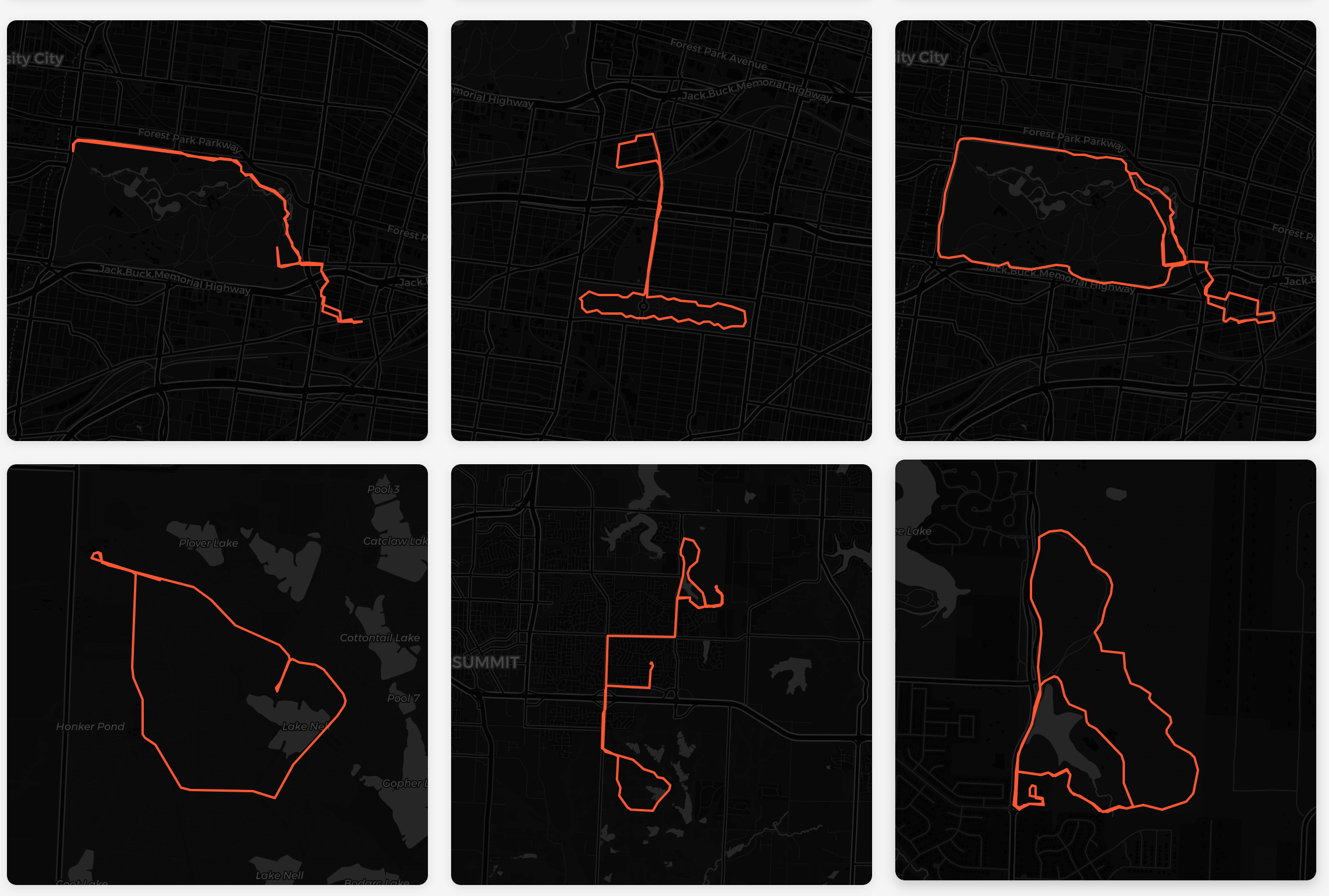
Running Routes Map
Over 1,300 Strava runs visualized with route details, elevation profiles, and statistics.
Leaflet
Chart.js
GeoJSON
Web Application
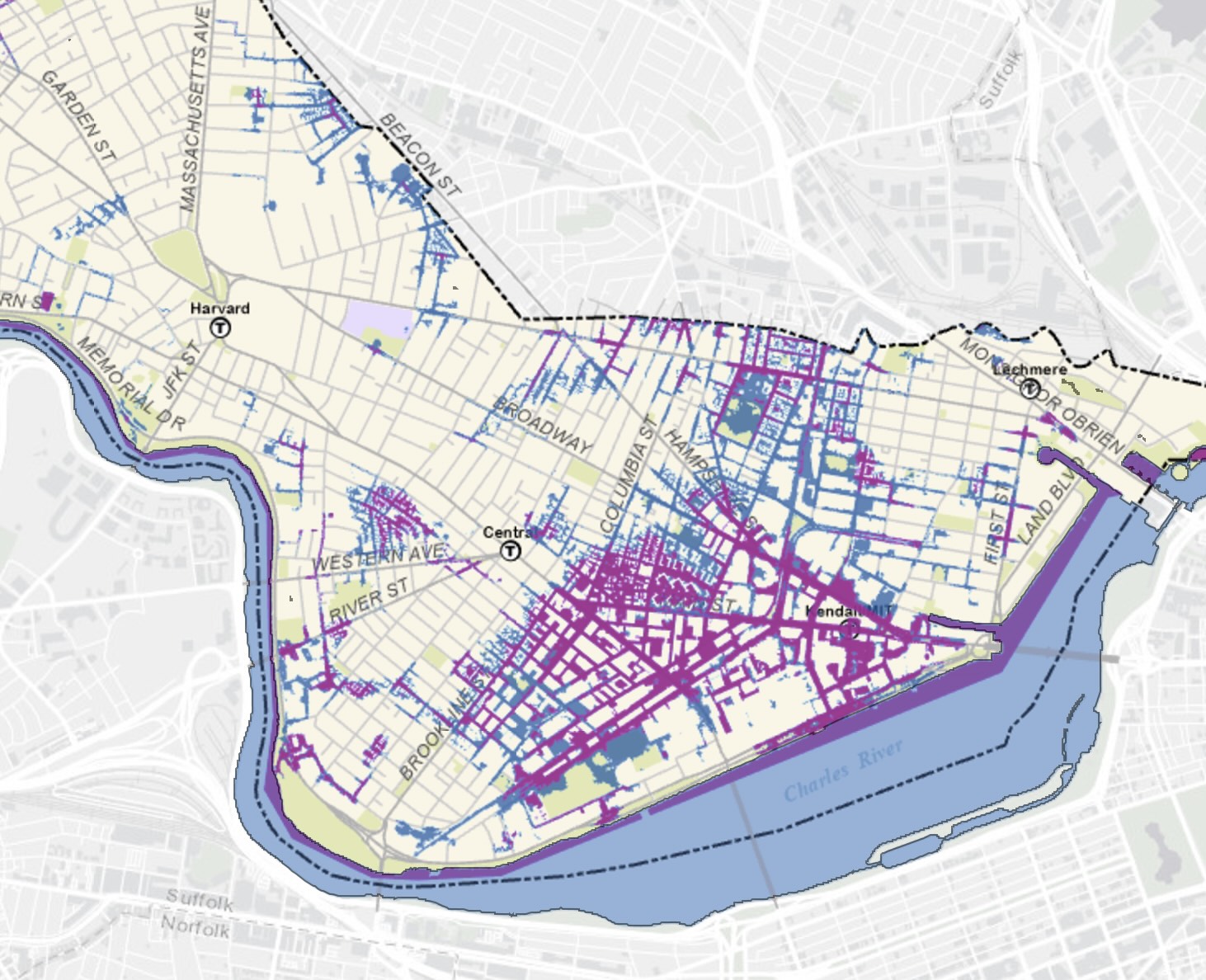
Cambridge FloodViewer
Flood risk analysis tool built for the City of Cambridge using ArcGIS WebAppBuilder.
ArcGIS
WebAppBuilder